
When audiences ask where are canadian wildfires are, they’re usually after three things: which provinces are burning, how the locations shift over the season, and where smoke is drifting. Canada’s fires are highly regional and cyclical—British Columbia and the Northwest Territories often dominate midsummer headlines, while Ontario and Quebec can flare dramatically in late spring or early summer. Prairie grasslands ignite during hot, windy spells; the Atlantic provinces are episodic but can still see fast-moving burns in dry years.
To make sense of where are canadian wildfires, you need a simple framework: understand typical hotspots, learn the seasonal calendar, and know which maps, alerts, and air-quality tools to check in minutes. This guide delivers all three with clear subheadings, scannable bullets, and plain-English explanations so you can quickly orient yourself, stay safe, and share credible, up-to-date context with your readers or clients.
Where are canadian wildfires?
At any given time, wildfires cluster where fuels are dry and winds align—often in British Columbia, the Northwest Territories/Yukon, northern Alberta/Saskatchewan, and large forest belts in Ontario and Quebec. Conditions shift weekly, so check national and provincial fire maps plus air-quality dashboards to see current perimeters and smoke.
Canadian Wildfires Maps Smoke Alerts and Seasonal Patterns
Wildfire geography in Canada follows climate, fuels, and access. In the western cordillera—especially British Columbia—mountainous terrain funnels wind, summers run dry, and dense conifer stands create abundant fuel. Lightning ignitions are common, and when high-pressure domes park overhead, fires spread quickly in steep, hard-to-reach country.
Farther north, the taiga and boreal zones of the Northwest Territories and Yukon swing between quiet and explosive years. In active summers, headlines and satellite heat signatures light up the map as lightning sweeps across parched muskeg and black spruce. Vast distances complicate suppression, so incident teams triage to protect communities, infrastructure, and cultural sites.
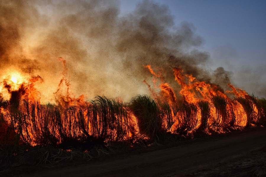
The Prairies—Alberta, Saskatchewan, and Manitoba—mix forest with grassland. On windy, low-humidity days, grass and shrub fires can run fast, while forested northern belts can sustain larger, longer-lived incidents. Alberta’s north and Saskatchewan’s forested fringes often host multiple concurrent fires, while southern prairie burns can be brief but intense.
Ontario and Quebec contain Canada’s largest continuous swaths of boreal forest, enabling large-scale seasons when spring snowmelt is early and rains are late. In those years, activity shifts eastward: perimeters proliferate north of major population corridors, and smoke can push into cities in Canada and the U.S. Suppression there often relies on aviation because of lakes, wetlands, and limited road access.
Atlantic Canada—New Brunswick, Nova Scotia, Prince Edward Island, and Newfoundland & Labrador—typically faces fewer large wildfires, but drought periods can change the script. When fuels cure and winds rise, interface fires near communities become the core risk. During Atlantic dry spells, local burn bans and rapid initial attack coverage matter most.
Finally, “where” changes with the weather. Blocking highs, lightning outbreaks, and wind patterns can migrate hotspots within days. The most useful approach is to pair an overview of regional tendencies with live sources: national/provincial maps for active fire locations and air-quality/smoke models for plume trajectories.
Canadian Wildfires Seasonal Shifts and Regional Peaks
Canada’s wildfire season moves in waves, not a straight line. From spring grass cures to summer lightning bursts and uneven fall tapers, the hotspots shift with weather, fuels, and crew availability.
Spring ignition window (late April–June).
Snowmelt exposes cured grasses and leaf litter before green-up. Ontario/Quebec and the Prairies often see early spikes; east-central Canada can light up in this phase.
Peak summer (July–August).
Dry, hot patterns focus activity in British Columbia, northern Alberta, and the Territories. Lightning drives much of the ignition load; the center of gravity leans west and north.
Shoulder season shifts (September).
Cooler nights and moisture arrive unevenly. Some years taper quickly; others see late surges if drought persists. Crews prioritize containment and demobilization while watching for wind-driven flare-ups.
Outliers and anomaly years.
Blocking highs, El Niño/La Niña, or prolonged drought can rewrite the calendar, pushing significant events earlier, later, or into atypical regions.
What shifts the map week-to-week.
Wind direction, humidity, lightning density, and resource availability drive the moving target of active areas in any seven-day window.
Tools & Tactics — Fast Ways to Check Current Locations
Need fast, reliable ways to see what’s burning right now? Pair official incident portals and provincial live maps with satellite heat layers, smoke forecasts, and local alerts for a clear, current picture—then use preparedness checklists to act on what you find.
- National coordination portals.
Start with the federal incident overview for consolidated perimeters, status, and sitreps—a quick top-down dashboard before zooming into provinces. - Provincial interactive fire maps.
Live maps flag out-of-control, being held, and under control incidents, plus restrictions, closures, and advisories—your best ground truth for roads, parks, and communities. - Satellite heat/thermal layers (near-real-time).
FIRMS/VIIRS hotspots reveal remote ignitions between official updates. They’re not final perimeters, but invaluable for rapid scans across vast boreal territory. - Smoke & air-quality models.
AQI dashboards and forecast plumes clarify downwind impacts—useful even far from flames when visibility, flights, or school events are in play. - Emergency alerts & municipal pages.
Local emergency sites post evacuation alerts, orders, and re-entry info faster than national feeds—critical for community-level decisions. - Preparedness checklists & defensible space.
Homeowners in wildland-urban interfaces should follow defensible-space basics. During heavy smoke, schedule short recovery breaks and use a <a href=”#”>minute timer</a> to pace 5–10 minute indoor intervals with filtered air before heading back outside.
Canada Air Quality and Wildfire Readiness for Trips and Work
When people ask about wildfire locations in Canada, they often need to know how smoke, closures, and power reliability will affect daily plans. Start with air-quality dashboards and match plume forecasts to routes or event timing. Build buffer time for visibility-related delays and consult provincial road advisories; operations can close highways with little notice.
For outdoor workers, rotate tasks to reduce exposure during peak smoke hours and stock NIOSH-approved respirators. Event planners should secure indoor alternatives with filtered ventilation, especially for youth and older adults. If you manage fleets, pre-stage maintenance for air filters and keep engines fueled in case detours extend mileage. Travelers should confirm accommodation policies around evacuations and look for flexible booking terms. Community communicators can add “what to do today” boxes: hydrate, reduce strenuous activity, set up portable HEPA units, and know two evacuation routes. Keeping tabs on active fires is less about fear and more about readiness: if you can find them on a map, you can usually find a safe, workable plan.
After the Front Passes Rechecking Canada Fire and Smoke Layers
Get to a go/no-go answer fast. Use these quick cues—region, ignition source, interface risk, and post-front winds—to decide what matters today, what could shift tomorrow, and what to recheck next week.
West vs. East quick read.
A blocking high locked over the Pacific Northwest raises odds in BC/Alberta; an early, dry spring warrants extra scanning of Ontario/Quebec.
North vs. South implications.
Northern boreal fires can be large and long-running; southern grass/shrub fires move fast. Today’s hot zone may not be tomorrow’s most impactful area.
Lightning vs. human ignition cues.
Thunderstorm belts suggest scattered starts; holiday weekends and changing burn bans hint at human-caused clusters near roads and towns.
Community risk triage.
Prioritize interface zones: if perimeters sit near suburbs or cabin belts, prepare for dynamic evacuations even when total hectares burned are modest.
After the front passes.
Rain can help, but wind shifts can wake sleeping embers. Re-check the same layers a day later; conditions can pivot dramatically after a cold front.
Conclusion
The most reliable way to answer “where are canadian wildfires” is to blend pattern awareness with live data. Western mountains, northern boreal belts, and Ontario/Quebec forests often dominate, but week-to-week weather can reshuffle the deck through blocking highs, lightning bursts, and wind shifts. Treat regional tendencies as the legend—use real-time layers for the actual map.
Bookmark national/provincial fire maps, satellite heat detections, emergency alerts, and smoke forecasts. Translate those feeds into choices for health, travel, and operations: check road advisories, build buffer time, line up indoor alternatives, protect outdoor workers, and verify air-quality impacts along routes. In short: understand the regions, watch the sky, and verify the map—because the best synonym for “current fire locations in Canada” is “where to act next.”
FAQ’s
What provinces usually see the most activity?
British Columbia, Alberta’s north, the Northwest Territories/Yukon, and large forest belts in Ontario/Quebec frequently host significant fires in active seasons.
How do I check current locations fast?
Open national/provincial fire maps for active perimeters, then confirm smoke impacts with air-quality dashboards and plume forecasts.
Why do locations change so quickly?
Wind, humidity, and lightning patterns shift week-to-week. A blocking high or storm track can move the hotspot corridor hundreds of kilometers.
Can smoke travel far from the fire?
Yes. Upper-level winds can push smoke thousands of kilometers, lowering visibility and AQI far from the source even when no local fire exists.
Are Atlantic provinces affected?
Less often, but drought and strong winds can produce fast-moving interface fires. Always check local burn bans and municipal alert pages.


