
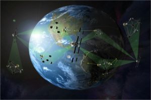
For many years now, activities related to spying via Earth observation satellite cameras were related to classified intelligence and military ops. Today, however, this statement is becoming less and less accurate, thanks to new companies launching satellites into space to provide real-time HD photos and video to anyone with an internet connection.
When it comes to privacy, it is normal for anyone to feel concerned. There are more than 5,300 satellite cameras in space, which only means that there are potentially thousands of cameras that can take real-time photos of you. In this article, we will learn whether these satellites can work for spying.
Not All Satellites Are Created For The Same Purpose
The first thing you need to understand related to “how do satellite cameras work” is that these devices don’t have the same purposes. Yes, while these are capable of clicking images from space, most of them are not concerned about your private activities. For instance, such imagery is often used by farmers to assess the growth of crops throughout the growing season. On the other hand, city planners make use of such imagery for mapping highways, etc.
One another satellite camera use is helping organize airmail and travel. Environmentalist helps track wildfires, hurricanes, and rising sea levels. The imagery can also be used to predict volcanic eruptions and map fault lines with data from radar satellites.
Some various types of such devices include the following.
- Scientific: For weather, evaluating agricultural patterns, space research, climate studies, health care, and biological research programs.
- GPS: For supporting navigation systems.
- Commercial: For mapping, entertainment-related purposes, and communications.
- Military: Mostly used for intelligence, defense, and reconnaissance.
Satellite Cameras Are Not Too Accurate
One reason why satellite cameras cannot be used for spying is that they are not very accurate. Movies often show space-spying satellites that keep zooming into a photo until you can see the freckles in somebody’s face. However, this is not true.
No matter what cameras do satellites use, photos are not accurate the same your mobile device’s camera takes. The pixels you see on the images have a one-meter resolution, meaning that every pixel covers 1sqmt.
In the case of satellite cameras, the image quality is always better when the image resolution is low. Let us look into some common types of resolutions that you would expect to find in satellite images:
- 50cm resolution: This is the most common type of resolution that is used in Google Maps. Typically, the images are pretty pixelated.
- 25cm resolution: This is the type of resolution used by satellites to provide public resolution. This type of resolution results in less pixelated images; however, the details are pretty blurred.
- 5cm resolution: Based on experts, this is the type of resolution that you would see in spy satellites. For instance, you can determine defined shadows on the sidewalk, wet spots from melted snow, or two people talking to one another.
- 1cm resolution: This is the type of resolution that you would expect to find in high-end spy cameras. This resolution will allow you to see bits of trash on the sidewalk, cracks on the ground, clothing details, etc.
In most cases, the photogenic capability will determine the accuracy of the satellite data. However, most satellite camera resolution is not enough to pry into the private life of an individual.
How To Use The Satellite Camera?
Another significant aspect of spy cameras is that they can determine various types of Earth observation data. In this section, we will learn how to use the satellite camera for purposes other than spying:
1. The Rapidly Melting Himalayan Glaciers
It is not easy to keep track of the glacial melt in the Himalayan region. In the case of Alaskan glaciers, you will see a lateral recede as they keep melting. The same cannot be said about the Himalayan glaciers because they change differently, making it tricky to track the changes.
Scientists can now make use of detailed satellite imagery to estimate the surface of the glacial changes. They can now create digital elevation models of glaciers by digitizing the overlapping images. Using these images, scientists have concluded that the glaciers have lost more than a quarter of the ice mass since 1975.
2. Loss Of Herding Ground For Reindeers In Finland
Spy satellites can have quite a substantial impact on fauna as well. For instance, reindeer herding has been the way of life in northern Finland for more than a century; however, the modernization of Finland has resulted in squeezing herds into smaller habitats and blocking migration corridors.
The use of spy satellites has revealed that roughly a quarter of the native herding districts have been disrupted since the late 1960s. Of course, there are quite a few changes that are caused by humans – for instance, deforestation has become a blockage for the reindeer as it threatens its only food source in the winters – lichen.
3. Encroaching Landslides On Farms In Peru
Spy satellite camera access has allowed scientists to track down and prevent a potential hazard in Peru. Landslides have proven to be slow but disastrous for the farmers in the Siguas and Vitor Valleys. In the past four decades, the landslide has covered 7% of the valley floor.
Scientists and researchers make use of these satellite images to track down the source of the landslides. While this particular region cannot be saved, it can help prevent future damage.
Final Thoughts
Of course, we all already know what is satellite camera. However, we did not know that a spy camera cannot pry into your personal life. Even if they could get an image, the picture would be too blurry to make anything out. However, this technology is being designed and improved to help other aspects of human civilization, not spying. Therefore, you can rest assured knowing that the spy satellites are not really targeting your head.


